Trails

The Municipality of Port Hope has a variety of walking, hiking, and cycling trails. These trails are geared to all types of sports enthusiasts. Trails run north from downtown to the rural portion of the municipality and connect as far as the Bruce Trail in Collingwood.
Hiking trails
Grab your hiking boots to experience Port Hope's outdoors. We have well-marked forest trails that bring you close to wildlife, and others that start in the heritage downtown and follow the streaming Ganaraska River or take you to panoramic lookouts along the waterfront. Learn about our many hiking and recreational trails.
The Sculthorpe Marsh parking lot is closed to accommodate the industrial cleanup work conducted by the Port Hope Area Initiative at the Chemetron Lagoon. Alternative parking is available at the corner of Lake Street and Hope Street, and overflow parking is available further down the Waterfront Trail, at Gages Creek. Trail access in the area remains open but watch for future updates regarding trail improvement work to take place in this area soon.
The Waterfront Trail |
|
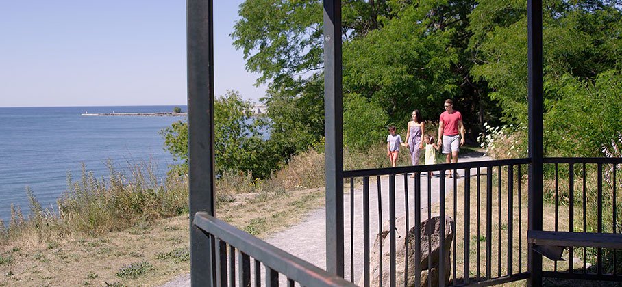
The Waterfront Trail runs along Lakeshore Road to the west of the Municipality and to Gage’s Creek to the east. The Waterfront Trail features benches, bird feeders, and gazebos and pays tribute to the community leaders who played key roles in the trail's development: the Keith Richan Walkway and the A.K. Sculthorpe Memorial Woodland Marsh. The A.K. Sculthorpe Marsh includes a partial boardwalk and lookout where to you can stop to view wildlife and wetlands. Download the Waterfront Trail Map Trail information
|
The Ganaraska Trail - Pine Ridge |
| The Ganaraska Trail Pine Ridge section starts at the cairn in Rotary Park along the Ganaraska River, opposite the Town Hall. With 65 kilometres of mixed terrain, areas of the trail can be difficult. Be sure to see the Fish Ladder that was built to assist fish to bypass the dam near Highway 401. |
The Ganaraska Hiking Trail |
|
The Ganaraska Hiking Trail was started in 1968. It connects with the Bruce Trail near Collingwood, making the trail almost 450 kilometres. The Ganaraska Trail Pine Ridge section forms the start of this trail in the downtown core of the Municipality. The trail offers an enjoyable walk along the banks of the Ganaraska River to the Port Hope Conservation Area near the Highway 401 underpass. All sections are challenging and geared towards walkers only. This section offers many opportunities to see wildlife and old growth trees. During the wet spring, the area should be avoided as river flows can become dangerously high and it is not recommended for children. Please note: the southern access point to the Ganaraska Millennium Trail will be closed for highway expansion work until at least 2028. During early spring, you can see the fish ladder filled with spawning trout making their way up the river. In the fall, large Chinook salmon, sized of up to thirty to forty pounds jump the ladder near Corbett’s Dam. Beyond the local section, the trail passes through the Ganaraska Forest, through the Kawarthas to the Canadian Shield. Download the Ganaraska Hiking Trail Map Trail information
|
The Urban Ravine Lands Trail |
|
The Urban Ravine Lands Trail is a connecting trail starting from the Ganaraska River and runs west to Port Hope High School. |
Cycling trails
Cycle downtown Port Hope with a tour of the Heritage District to see over 230 historically restored buildings. Tour north outside of town to the countryside to many quiet roads for cycling. Most roads in this area are paved.
Cycling to the west of the downtown section along Lakeshore Road offers scenic views of Lake Ontario. Cycle into the village of Wesleyville past the old school and church. Many trails will involve hilly sections due to the natural terrain.
Ganaraska Forest trails
The Ganaraska Forest is located within a one-hour drive from Toronto. It is in the north portion of the Municipality of Port Hope. Year-round recreational opportunities are available at the Ganaraska Forest. The 4,000-hectare property includes over 100 trails for hiking, mountain biking, and horseback riding. In the winter, activities such as cross-country skiing and snowshoeing on groomed trails are available.
The central section of the forest is maintained as a passive use area. The east and west forests allow motorized use such as off-road motorcycle riding, ATVing, and snowmobiling.
To reach the Ganaraska Forest Centre from Highway 401, follow Highway 28 north to Ganaraska Road, turn west and travel 2 kilometres past Garden Hill to Cold Springs Camp Road. On your way to the Forest Centre stop at the top of Dean’s Hill and take in the view of the countryside from Richardson’s Lookout. Follow Cold Springs Camp Road for 4 kilometres to the Forest Centre buildings and offices.
For more information, call the Ganaraska Region Conservation Authority at 905-885-8173.
Visit the Wildlife webpage for more information about wildlife in our community.
